Thursday, June 30, 2022

Sawtooth Lake

If you've seen one, you've seen 'em all. Sawtooth Lake was not unlike Big Pine Lakes or Sky Pond: they are all frozen alpine lakes. The view on the way up was nice though. The trail looked down on another lake surrounded by towering mountains and cliffs. That's where I met a girl from northern Cal, now living in Grand Junction. She was thrilled with the view that she has never seen before. She obviously didn't hike much in California. Or in Colorado for that matter. Had she done that, she would've recognized the similarities.

After the Alice Lake Loop, I spent a day mostly resting at the campsite by Iron Creek. In the morning I went up Iron Creek to check out the trailhead and use the bathroom. There were much nicer campsites along the way. The site I took was tiny, not big enough for the car and the tent. I had to chop a sapling to secure enough space to pitch the tent. The ones I found further up Iron Creek were huge, shaded and flat. On the way back, I parked in one and napped for a while. Then I went to Stanley RV to get my car charged up. I was going to Idaho Falls in 2 days and that was good for 200 miles.

The hike to and from Sawtooth Lake was about 10 miles. I was in a terrific condition after a day of rest. I started out around 9AM and I was back at the trailhead before 3PM.  I didn't spend much time at the lake. It wasn't much different from other alpine lakes, and you couldn't walk around the lake either. You could go about a hundred yards on each direction, but there was no trail that circled the lake.

The campsite that I napped in the day before was taken. I came back to my tent, parked my car in the shade nearby and rolled around in the car till the evening. 


Wednesday, June 29, 2022

Alice Lake

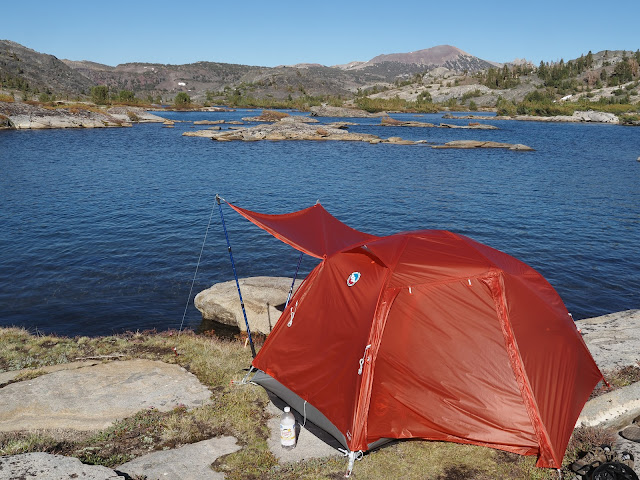
The campsite by the creek wasn't leveled. But it was the only dry place available in the snow-covered valley, and I was thankful that I could pitch the tent at all. I managed to sleep well despite rolling down and then pulling myself back up a few times over night. Anybody would've slept well after an ordeal of slogging through the snow like I have the day before.

I packed up and moved on as soon as the day broke. I had a long way to go. I had to make it to Alice Lake, still 4 miles away, and then it would be another 8 miles from there to the trailhead. And who knows what kind of obstacle is waiting. I only made 6 miles the day before, after all. I had to start early today. 

This time, I went up the bowl following the creek. I applied the lesson I learned the day before, in other words: there is no point trying to find the trail buried under the snow; just follow the gradient path. And I found the trail once I climbed up the bowl onto the plateau. I repeated losing and finding the trail a few times and then I was over the ridge on the left side of the plateau. Then the false trail once again misled me, to a ledge of snow above a cliff. I backtracked, eventually found the trail again and I was on the other side of the mountain looking down at a few unnamed lakes far below in the valley. Twin Lakes then appeared as I rounded the corner. I was getting there.

The snow ledge above the cliff that I almost fell off from

I don't remember much after that other than slogging through the snow some more and then pooping near a small lake. Got lost a few more times while skirting that lake, and I was at Alice Lake, where I should've been yesterday, finally.

Alice Lake

Alice lake was a beautiful, clear lake, not unlike Thousand Island Lake, only without islands. I must've come down quite a bit from the peak -- there was much less snow by the time I got there. The snow would eventually disappear shortly after Alice Lake. I had my lunch by the lake, spent an hour or so, and moved on. I left my water filter and bottle there and I had to back track after a mile, only to lose it while crossing the creek.

The water was raging. From Alice Lake, you follow the creek all the way to Petite Lake. You also have to ford the creek a half dozen times as the trail zigzags across the creek. Walking across the ranging creek is more terrifying than slogging through snow or bushwacking through woods. On the first crossing, I almost fell. I recovered, but the water bottle fell out from my backpack and floated down the creek. The bottle had the filter attached to it and therefore was top-heavy. To make the matter worse, the pocket in my backpack was slanted, making it easy for the bottle to fall out. I tried to chase it and then quickly gave up when trees separated the trail from the creek. The water was faster than I could run anyway.

Other than that, the trail was trouble-free. Not having snow made trekking easier and pleasant, at least in between the creek-fording. I took some time to wash myself when I got to Petite Lake. I was going to sleep in the car, so I had to wash myself. And the lake was as good a place to wash as any. I then got to my car, drove to Redfish Marina and had a burger dinner there.  Bath and dinner taken care of, I went to Iron Creek and slept in the last campsite that was available.

Back in my car at the trailhead


Sunday, June 26, 2022

Edith Lake, ID

The problem of writing up a trip after 2 months of traveling is that things collide in your memory. In this instance, the beginning of the trail to Edith Lake gets mixed up with the one to Big Pine Lakes. Maybe because the trailhead and the initial a few hundred yards looked similar. I remember stopping at the trailhead, take picture of the trail map and walking into the woods. But I do that at all trailhead; my trailhead ritual wasn't particular to these two trails. Perhaps the fact that both trails had the body of water to the left at the beginning of the trail and then started ascending shortly after made their memories fuse. The trail to Edith Lake briefly skirted Pettit Lake and then veered to left to start the counter clock-wise loop. The Big Pine Trail had the Big Pine Creek to the left and then veered to the left in similar fashion.

So, I no longer have much memory of how I got to Edith Lake other than crossing the creek with a young couple. I got to the water's edge and was having a snack. It didn't occur to me that I had to cross it to continue. A couple came and thought I was looking for a way to cross. There was no obvious crossing. The water wasn't too deep -- about knee high at the deepest point -- so I figured we should just cross it. But the young man went downstream to look for an easier way. He eventually found a log bridge and we walked over it. It probably was easier just to ford the creek than walking over the gnarly log, but we kept out feet dry. We split up shortly after -- they walked faster than I did -- then I saw them taking lunch break by the creek. They must bush-whacked a few hundred yards down to the river when the trail started ascending. I was lying on a log and taking a break when they caught up with me at the junction to Edith Lake. They continued on and I never saw them again. I camped by Edith Lake and they must've either continued on or decided to turn back at the junction to Imogene Lake where the snow made it difficult to continue on.

A little birdie told me that there are good spots up on the top of the hill near the outlet. I climbed and voila, there was a few perfect tent sites. I took the dry one at the top that had view of the mountains on the other side of the valley and the Farly Lake in the valley in distance. Then I commuted to the lake for daily bathing with ice water. You can easily erase the memory of cold bath. 


I stayed here for two nights. I figured I could day-hike to Imogene Lake which was the original destination. I was exhausted by the time I got to Edith Lake and decided to camp there. The trail to Imogene Lake looked gruesome -- lots of switchbacks and steep climb -- and there was no way I could make it. Camping and then day-hiking to a spur trail usually works out really well and I was sure it would here. Turned out, the trail to Imogene Lake was impassible. The gruesome trail, probably with lots of rocks and steep fall-off one the side of the trail, was covered was snow. My foot fell through the snow as I climbed next to a boulder and dangled in the big gaping hole. That is probably how Kim Hong-bin, an experienced mountaineer, fell through crevice in Himalaya. It probably was a safe-looking stretch of the trail. The snow suddenly gave way, exposed the crack and he fell. I turned around at that point.

The collapsible 5L wash basin was the smartest purchase I made for the backpacking. I have to wash in the evening to sleep. Without washing, the sticky body stops me from falling asleep. I took the basin down to the outlet creek, scooped the ice water and took a bath. 


Friday, June 24, 2022

Tin Cup Trailhead

The first thing on my way as I drove into Stanley was the familiar looking meadows with creeks crisscrossing it.  It is familiar not because I've been here before, but because it is the picture that drew me to Stanley at the first place. How could anyone resist streams flowing through a picturesque meadow with a backdrop of snow-capped mountains? I would be the last one. I dream of streams whenever I have the most restful sleep.


It was Friday afternoon when I got to Stanley. And it was unlikely that I would find a campsite given the popularity of boondocking along Salmon River. I shuffled my plan and decided to do the Loop first. By the time I return to Stanley on Monday or Tuesday, campsites should open up. Then I'll camp out for a few days and do a few day-hikes from Iron Creek Trailhead. The change meant that I'd sleep for the night at Tin Cup trailhead where the Loop starts.

But I had to charge up the car first. I drove almost 200 miles from Boise, 60 of which was on gravel, and the car had only about 30 miles left. I pulled into Stanley RV and Basecamp, just across the meadow that Stanley creek runs amok in, paid $5. In return, they gave me 4 hours of charging time and an access to the shower. I then fixed pasta in the evening while charging. I took care of charging, shower and dinner there. What a bargain. Friendly pair named Joe and Sheryl made it a real pleasure. I'd repeat the process 5 days later when I came out of the Mountain.

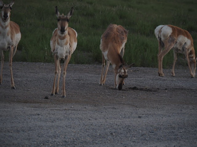
The meadow along the Salmon River was another stunner.  It runs through the valley between Sawtooth Mountains and the ones that form Salmon National Forest. Animals are plentiful here. I encountered a large group of antelope-looking deer that I couldn't name at the entrance to Tin Cup Trailhead. Where there weren't wild animals, Cows were grazing.

I didn't do much in the town of Stanley. I needed groceries, but the Mountain Village Merchantile, the only grocery in town, was closed. The drove past it to the valley where the route 75 follows the Salmon River. Then I had to drive on dirt road for about 2 miles to get to the parking lot. I parked far from the trailhead where I thought I'd get the best protection from the sun, set up the car for the night, fixed dinner and went to sleep.


The Road to Stanley

The bullet holes on the bathroom door at Willow Creek Campground, where I stopped to take care of the morning business, were reminders that I was no longer in CA. Someone has made dozens of dents on the metal door, probably to entertain themselves. 


I continued on Arrow Rock Road along the Boise River. It then changed name to Middle Fork Boise River Road about halfway. I passed a gorge where the river raged and turned north before Atlanta. I don't remember the name of the road, but it appears to be Pheiffer Creek Road. One of the pictures I took was taken at the junction of Pheiffer Creek Road and Rabbit Creek Road. I know I followed the Boise River North Fork in the direction in flowed, past Fourmile Campground, after that.


It was unplanned discovery. The forest road 327, which became Rabbit Creek Road after the junction, followed the North Fork, a smaller and clearer branch of Boise River. In effect, I went up the Middle Fork and then followed down the North Fork on my way to Stanley. Then I turned north on NF-384, also known as Little Owl Creek Road to get to ID-21, known as Ponderosa Pine Scenic Byway.

The Payette River was another unplanned discovery. The scenic byway runs mostly through, well, ponderosa pine forest.  Then it meets up with the Payette River at Lowman where it really gets scenic. I skipped the ponderosa pine portion of the byway and jumped to the Payette River.

It was a kick-ass river route that follows up the Boise River Middle Fork, down the North Fork and then up Payette River which flows somewhat parallel to Snake River and then joins it in Payette. It's a must-route for any river-philes likes me. It was one of the most scenic and memorable drive. I'm sure the 60 miles on the dirt road took a toll on my car, but it wasn't as bad as Hole in the Rock Road of similar length.


Thursday, June 23, 2022

Blue Heart Spring and Boise River

Blue heart Spring was a small cove behind wooded peninsula and murky water. The entry to it is unremarkable and easy to miss. I was looking for a fork thinking that it was at the inlet of the box canyon. There was no canyon and the cove was behind a overgrown peninsula. I paddled a few hundred yards past it and then came back when there was nothing ahead.


I stopped at Ritter Island on the way to Boise hoping to hike to one of the thousand springs falls. There was a fall alright, but it was only a few hundred yards from the parking lot. I took a few pictures, spent some time at the spring fed Creek and then left for Boise. 

The 100 miles to Boise felt like an eternity and I could barely keep my eyes open. I plugged car in and then climbed into the back of the car when I got there. I did the planning for the Boise River and Stanley, and took a short nap. Then I grabbed food from Panda Express -- the same Panda Express we grabbed lunch from when we we here in 2019 -- and I was off to Boise River.

I swore that I wouldn't do dirt roads. Yet, here I was again on another long dirt road. This one was about the same as the one through Colob Terrace from Lava Point to Cedar City. About the same length as well to Atlanta. But I'm not going there. I may not have enough left in the tank to make it there and then turn around to get to Stanley. I'll split about 15 miles before Atlanta and head north to Stanley. Which means I'll be missing Chattanooga Hot springs. But there will be other hot springs along the way. Not the end of the world.

Boise river is quite a spectacle. Who knew Boise, which is missing Snake River, has even better one? I'm parked by it at Willow Creek Campground with a spectacular view of the river. But it is interested with mosquitos. I was having what I picked up at Panda Express, but I had to move back into car. I brushed my teeth and climbed into the back as soon as I was done. So much for enjoying the river.


The road to US-20 to Stanley may also be unpaved. I'll be driving on dirt road for 60 miles, if it is. 

Wednesday, June 22, 2022

Banbury Hot Springs, ID

The sun was setting by the time I got to Elko; I didn't get to see the scenery on US 93 last night as I was driving to Jackpot. But I guessed that it was getting greener as I got closer to the Idaho border. Signs were flashing for deer and there were overhead passes for animal crossing. There must be enough vegetation to support large animals. As I was leaving Jackpot, I did see it getting greener. Parched brown of Nevada faded as I left Jackpot and crop circles appeared soon. It was a sure sign that I was getting closer to the Snake River.

In the morning, I stopped at Casino 93, used their bathroom, grabbed free coffee and I was on my way to Twin Falls. At 8:30, I plugged in the car at the visitor center and used their bathroom to clean my face. Then I hopped over to Ross -- the shopping centers were right on the cliff of the canyon -- to get a sunscreen and then I was off to Shoshone Falls.

I had to give up the Cliff Trail to Shoshone Falls when I was here in 2019. It was 9 miles, in and out, and my limit then was 4 miles. But now that I have done 16 miles on Big Pine Lakes Trail, this was to be a walk in the park. I didn't even carry anything other than 1L of water. I was getting hungry after 11am and I wished I brought snacks. But I pressed on to the fall and got there around 11:30. I was back shortly at around 1:30.

I planned to do Blue Heart Springs in the afternoon. But I felt too tired when I was done with lunch at 3pm. I decided to check out Twin Falls downtown and then spend the night at Banbury Hot Springs. It's not a bad deal. I paid $10 for overnight parking and I have access to the shower. I'll do a snack for dinner -- I had a big lunch at Mo Betta -- and then go down to take a shower. I'll kayak to Blue Heart Springs tomorrow morning and then I'll be off to Boise.

Jackpot NV

The sign says 300 miles to Salt Lake City. I'm not going there. I'm going as far as Elko and the head north toward Twin Falls shortly after. 

Sharon, my sister, and her husband passed through here for sure. They probably have made all way to Salt Lake City on their first day. They must have, to make it to New Jersey in 4 days as they have. I can imagine how their conversation went as they passed here. I can hear his husky yet loud voice going "whoa" about the vast expanse of desertscape and brown mountains. And it no doubt would have involved God's glory and his creation. Then they would've told themselves they were glad they were leaving the West and going back to the east coast. The power of positive thinking that newborn Christians are famous for, no matter what the reality is that compelled them to move, lock stock and barrel, back to east.

That was 3 years ago, and he is now gone. He was diagnosed with Lymphoma shortly after and then passed away the next year. Sharon will be gone too in due time and there will be no one left to tell their stories. Maybe they told their stories to their children, and they will remember for a while. But then they'll be gone too and nobody will know that they passed here on that summer day. Just like my parents' stories will be forever gone when I'm gone. None of their grandchildren knows their story. None of them bothered to show up at their funeral either. 

I drove through the night and got to Jackpot at 10 pm. The campsite by Salmon Falls Creek was not accessible by a car -- I needed a high clearance vehicle to go any further. So I drove onto grass field by the trail and slept there. The creek wasn't much of use at 10pm anyway and I was going to leave to Twin Falls as soon as I get up in morning. 


Sunday, June 12, 2022

Back at Agnew Meadow via High Trail

OK, I'll take back what I said about Thousand Island Lake: it is just what I expected.


Just a new hundred yards from my campsite was a sandy beach cove. The sandy color gradually turns to turquoise as it moves to the center. I spend an hour soaking up the sun in the beach after taking a dip. The sun was intense thanks to the altitude. I was going to circle the lake. About halfway to the western end of the lake, a poop attack stopped me cold on the track and I had to get back to take care of the business.

The return path took me 9 miles along PCT. Soon after you leave Thousand Island Lake past the lake outlet, you merge into High Trail with the view of Minaret all the way back to Agnew Meadow. It essentially goes parallel to Shadow Creek trail at higher elevation, thus supplying the view of the high Sierra. So, on the way in, you follow the creek in the shade. On the way out, you get the view in sun. One of the best loop trails, if not the best, there are.

I was pooped out by the time I got to Agnew Meadow. My feet were sore, I couldn't imagine hiking another 3 miles up the road back to my car in Minaret Point. I walked for a while and then hitched. A pickup with 4 Mexicans working in the park stopped and let me squeeze into the backseat. It was a long climb and the hitch probably saved my day. On the way back I forgot to return the bear canister to the ranger station. I drove 50 miles and then returned back to Mammoth Lakes.

In all, about 28 miles in 4 days. The backpacking equipment all worked out well, I'll be taking them through Idaho and Wyoming for "Electric Hobo" season 2.

Friday, June 10, 2022

Day off at Thousand Island Lake

There is no flat land around the lake. You have to hike up the hill to be 200 feet away from the water or trail. That's a chore, especially after a long day of hiking. It's not much better when you are all puffed up and stiff in the morning. Then you dig a hole 8 inches deep, and that'll take whatever the breath remaining after the climb. If you don't have an appropriate tool, you'll have to improvise with the sharpest stone you can find. Squatting down is no easy proposition either. Your body aches from hiking and holding in that position for however long it takes to empty the cargo can be a murder. Then you hold on to tree branches do the deed and bury the deposit. Getting back up is impossible unless there are tree branches that you can grab on. Pooping in a bucket will feel like a luxury when you are done with the whole schtick of pooping in the hole on the ground.

I don't know why I'm pooping so much when my diet is devoid of any fiber. It consists of oatmeal, candy bars, instant ramen and spam. The strain of walking all day with 30-pound backpack must've been stimulating my bowel.

So, I'm all pooped and rested this morning. I'm fairly clean too: I managed to wash my head and limbs yesterday when I got to Thousand Island Lake. No mosquito problem either. It's been windy since 9AM and all mosquitos were swept away. I hope it remains breezy for the rest of the day. It's my day of rest. I'll explore around the lake in the afternoon and perhaps take a dip in the lake. The water here doesn't feel too cold, perhaps because the lake is shallow.

Thursday, June 9, 2022

Thousand Island Lake

After two 11000 feet pass, I'm reconsidering doing JMT. The second one in particular took a toll on me even though it was only half of the elevation gain of the first one. The second one was as emotionally demoralizing as the first one was physically exhausting. It might have been alright if I continued to the top without stopping. Thinking I was almost there, I stopped for a lunch break. Then the pass went on and on. It was like Crags Castle: when you think you are there, another hill appears.

In reality, the first pass were only 1000 feet tall, and the second one 500 feet. But they rose over 2 and 1 mile, respectively, making it a bit of challenge, especially if you are demoralized and carrying 30 lbs backpack.

I didn't sleep well the night before either, despite hiking 10.5 miles. My insomnia must be returning now that the CFS is ebbing. Sleeping well was a silver lining for 13 years and now it's time to say goodbye to it, I guess. I was in a good shape in the morning despite the bad sleep. I flew down to JMT junction from Ediza Lake in no time and started my climb up the first pass. The first pass went by without much drama and I was looking down at the spectacular Garnet Lake.

Garnet Lake and Thousand Island Lake are not exactly above the tree line. But, at about 10000 feet, they should qualify as alpine lakes. They certainly has clear blue water that comes from melt snow. Thousand Island Lake had more islands and peninsulas, but Garnet Lake has deeper blue water. It's more sparking. I'd choose to camp at Garnet Lake instead the next time. Perhaps when I do the JMT.

After the ordeal of the second pass was Ruby Lake, a smaller one with glaciers plunging into it's deep emerald water. Another lake I would've loved to camp at but was not allowed to. It is in the shade of the cliffs; it may be a little cold to camp there.

The Emerald was was anything but. I it didn't have that deep emerald color of Ruby Lake. Maybe because it was sunnier there, but Ruby Lake with it's glaciers looked about ten times better.

Then I was at Thousand Island Lake at last. Maybe I expected a lot, with everybody taking about it and all. But its water, dotted with islands was not as sparking. It felt more stagnant. Maybe Garnet Lake is the same around the shores where camping was allowed. I wouldn't know since I didn't camp there. But after seeing Garnet Lake from 500 feet above, Thousand Island Lake wasn't as satisfying. I'm spoiled by now after seeing so many pristine lakes, I guess.

I walked about half a mile and set up my tent in a peninsula. It seemed like the best spot in the whole lake, but nobody was on it. You need to bushwhack a bit to get to it and maybe that is the reason why. Three aren't too many campers here either.


Wednesday, June 8, 2022

Ediza Lake

PCT at Agnew Meadows was practically a traffic jam with steady stream of people poured out of High Trail. It must be the peak season in this section of the PCT. It's already June and people who started in April-May were arriving there. Good thing that there isn't much snow in the Sierras this year. It would've been a tough hike through the high Sierra in June if the snow level was normal. Still, there was enough snow to cover some of the trail when I hiked to Big Pine Lakes on May 21.

The trail today followed Shadow Creek pretty much all the way. After trekking for an hour, I met a fellow slow hiker who has been on PCT for 5 months. He must have left Mexican end of the trail in January. He was not going to get to Washington before the winter obviously, but he was not concerned. It was about experiencing the trail, not getting to the end of PCT, for him. He was probably who I will be if I ever do PCT.

Shadow Creek was more like a river than a creek. Impressive volume of water roared down the canyon and then widened into gently flow at places. It flows from Shadow Lake, which in turn gets it's fill from Iceberg Lake via Ediza Lake. When the trail veered from the creek and started to climb up, it became a waterfall gushing out of the canyon. I went off the trail, went down to the river and hadmy lunch there.

I'd have loved to camp by Shadow Lake. Its shallow, crystal-clear coves with sandy bottom would've been great for dipping too. But the destination was Ediza Lake, so I had to move on. No camping is allowed by Shadow Lake in any case. They must've wanted to keep pristine lakes pristine. Ediza Lake has clear water too, but debris and moss were floating around the edges where camping was allowed. The area around the outlet was clean and easily accessible, but no camping was allowed there. The inlet was supposed to be nice, but I had to hike further to get there. I was tired, so I pitched the tent by the easily accessible part of the lake. In all, it was about 10-mile day.

Tuesday, June 7, 2022

Minaret Point: The Beginning of Thousand Island Lake Loop

The lakes along Thousand Island Lake Loop, supposedly crown jewels of JMT was the proving ground for my backpacking gear. My backpack now weighs 30 pounds after adding food, water and bear canister. Certainly not an ultra-light pack. But I figured you just need to slow down by 5 to 10 percent for each additional 10 pounds. The physics of p=fv says so: for the constant power, you should slow down proportionally to the increase in weight. assuming a person weighs 100 to 200 lbs, the increase of 10 pounds is 5-10% of the total weight. Therefore, you should slow down by that amount.

If you are a type 2 hiker who gets a kick out of getting there fast, then the weight that you carry matters. I don't need to be there fast; I only need to get there for the novelty effect. Just hiking a few miles to get to a new place is enough to get my juice flow to suppress the exertion-hypersensitivity.

The road to Mammoth Lakes through South Lake Tahoe and Gardnerville was a familiar one. It was the same route that I took last year.
I got to Mammoth Lakes Welcome Center at 3 PM and picked up the permit and a bear canister. I then plugged in the car and went over to Grocery Outlet a block away to buy a couple of bottles of water. They didn't have one liter water bottle, so I bought ginger ale and tonic water instead. I drank them instead of water throughout the next day.

The road from Minaret Point to Agnew Meadows was closed, the ranger at the Welcome Center told me. I had to start my hike from Minaret Point instead of driving down to the trail head at Agnew Meadows. It's downhill going out, which meant additional 3 miles of uphill coming back. After 10 miles on High Trail, that'll be a murder.

There was no point going up to Minaret Point early. There wouldn't be cell connection there and I'd be out of things to do. I spent the rest of the afternoon in Mammoth Lakes and surfed the internet. I then went up to Minaret Point, soaked in the view of Minarets, fixed instant ramen for supper and then went to bed.

Saturday, June 4, 2022

Backpacking Plan

Things are moving fast. Original plan was to do the Electric Hobo season 2, the repeat of the car camping and hiking, and then get into backpacking next year. But now I got my backpacking gear and I'll be on the 4-day trip to Thousand Island Lake. And I'm already thinking about doing a thru-hike, as soon as next year.

Not all places are reachable by day-hike; backpack is sometimes necessary even for car campers. In fact, many "tasty" places require multi-day backpacking. To get to Reflection Canyon in Escalante, for example, requires overnight camping. 

For now though, getting there is the goal, not the backpacking itself. That means trips of a few days at the most to get to remote destination.  But I'm still planning out the gear as if I'm doing 2-person backpacking through JMT because I didn't want to get a new set of gears to do thru-hikes later on. That meant 65L pack and 2-person tent. The base weight came at 20 lbs. Add food and water, it'll be 30 lbs pack. It's not ultra-light by any means. But I'll have all the comfort in the world and I still can use it for JMT later.

So, new plan and new toys. Maybe backpacking will finally get me out of the remaining exertion hyper-sensitivity. Meanwhile, I'm still crashing after 4x1 block jogging. I get hit by the bus two hours after and get knocked out for a couple of hours. Then I get debilitated for the whole afternoon the next day. But the crashes only last hours, not days or weeks as it used to. It's an improvement. But I still have to plan so that I won't get debilitated when I have things to do. Which means jogging after 8PM so that, when the bus comes, I could just go to bed.